Affect of Hurricane Harvey on Google maps “traffic”

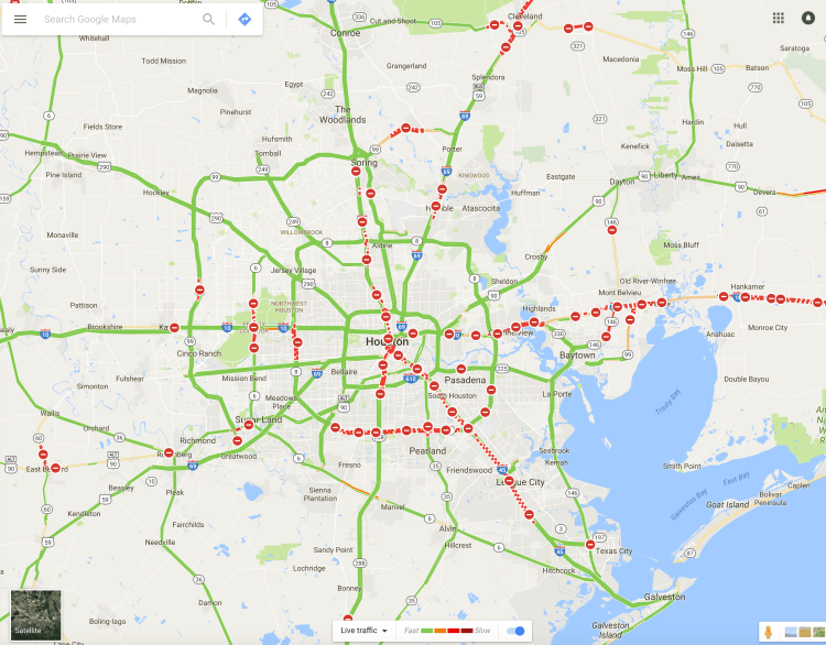
Take a glance at Houston, Texas on Google maps (with “traffic” selected) and you’ll see how much Hurricane Harvey is still affecting the area, 5 days after making landfall. The news this morning showed the storm over the Beaumont area, so I included a Google map of that town, also. The red-dashed lines are indicating road closures, which, when you see these images, is pretty wild to see how widespread it is. So many roads and highways are flooded.

screenshot_2017-08-30-07-34-01.pngscreenshot_2017-08-30-07-34-30.pngscreenshot_2017-08-30-07-35-13.pngscreenshot_2017-08-30-07-32-36.pngscreenshot_2017-08-30-07-35-31.pngscreenshot_2017-08-30-07-33-39.pngscreenshot_2017-08-30-07-34-54.pngscreenshot_2017-08-30-07-35-48.pngScreen Shot 2017-08-30 at 7.48.31 AM


Discover more from Out of the Wilderness

Subscribe to get the latest posts sent to your email.

Published by Ben Wilder

Since 2005, I've called Nashville home. I'm the leader of the pack, which includes a 13-year-old beagle and an 11-year-old blue heeler mix. My days include writing, video editing, and other fun activities. Thanks for checking out my blog, I hope you enjoy it!

Leave a comment

Discover more from Out of the Wilderness

Subscribe now to keep reading and get access to the full archive.

Continue reading